“Fin” removed from “Finish Line”.

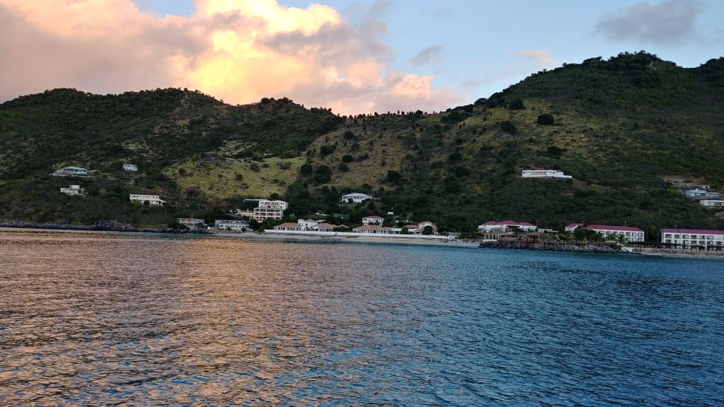
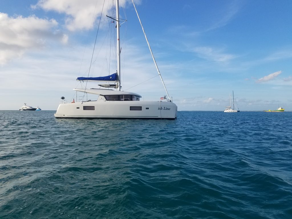
One of the tasks on our new boat was to remove the old decals. The old name “Finish Line” were on both bow pontoons, the hailing port was on the stern, and the charter logo decals were on both sides of the bimini.

After a little bit of research, the recommended removal mechanism was to purchase an “eraser wheel” and use that with a power drill. The eraser wheel is literally eraser material on a wheel that you put in the chuck of your power drill. It does a fine job of removing decals without damaging the gelcoat, but does take some time. Also, power is a little hard to come by, so I used a rechargeable drill. This worked fine when standing on a firm footing, but to remove the bow decals, I needed to stand in the dinghy and press the rotating drill against the hull. Due to the movement of the dinghy and the waves, this was not a trivial exercise. In addition, the eraser would come loose from the chuck and drop. The couple of times this happened, it landed in the dinghy, but I became paranoid that it would fall in the 25 feet of water and I’d have to go diving for it. Even worse, if the drill fell in the water, the saltwater would completely destroy the drill.

I removed the decals over several days (weeks) and Sydney thought it was funny that the name “Finish Line” had turned into “ish Line”.

Grand Case Bay

We anchored in Grand Case Bay on two different occasions as a respite from our time in St. Martin.  It is a decent little anchorage when there are no ocean swells, has good food, and a few supplies.

It also has a reputation for petty theft (mostly dinghys), so we were always on the look out.

Creole Rock

We were in St. Martin for about 4 weeks, largely because our depth finder wasn’t working and I had to order one from the states.  It took at least 2 weeks over the holidays to get it flown in.  So we made the best of our long time in St. Martin.

A couple of times, we decided to go up the west coast to Grand Case.  There are decent restaurants there, minimal supplies, and some decent snorkeling at the north end of the bay.

Creole Rock is on the north end, has a tie-up for dinghys, and is good snorkeling.  It is a little exposed to the ocean, but was not too bad the days we were there.

Kirsten kite boarding

Kirsten had made reservations with a guy on the French side to go kite boarding while we were there.  He took her out into the lagoon for an hour or so, and, by the end of the lesson she was doing very well. 

The lagoon has quite a few sunken and abandoned boats that rest on the bottom and are exposed above water that you have to avoid.  The instructor found a fairly open space where Kirsten could board and also float down-wind without running into any of the trash.

After the lesson and the foiling, we had lunch at a French restaurant at the resort where Kirsten took her lesson.  Due to COVID, there weren’t a lot of people there.  I believe we had a cheese plate with lunch because we had to show the girls the proper French lunch specials.  French cheese is always interesting.

Steve foiling

Kirsten had a kite-boarding lesson in Simpson Bay lagoon in St. Martin for an hour or so. After the lesson, she also wanted to try out the foil-board behind a power-boat. After a couple of tries, she got up on the foil and did pretty well. Then she asked if I wanted to try so I did. Very interesting feeling – while the board is in the water it is a very familiar feeling with friction against the board. When the foil kicks in and you rise above the water, the friction goes away. You’re also *way* off the water (at least it seems that way), so it is a little unnerving.

With the family

I believe this shot was taken from the top of Fort Louis in Marigot, St. Martin (the French side). This is a quick hike up from the dinghy dock and offers some nice views. The semi-circle you see in the water behind is the breakwater for the marina in Marigot. Our boat is anchored outside the marina a little to the right of the shot.

Simpson Bay, St. Martin

This shot was taken from our anchorage in Simpson Bay, on the Dutch side of St. Maarten/St. Martin.

We arrived here from a full 15 hour drive from the BVIs directly into the wind. We arrived about 5pm, about an hour after Sydney’s plane had landed, and quickly picked her up at the dinghy dock before the sunset. Legally, we weren’t even checked in to immigration yet, so we couldn’t officially go onshore, but she hopped in the dinghy and we went back to the boat, to check in the next day.

On the way to St. Martin.

This is a shot off the back of the boat during our 15 hour drive from the BVIs to St. Martin.  Waves were probably 5 feet that day and we were motoring directly into the wind the entire way.  We were on a pretty tight schedule because I wanted to arrive in St. Martin before sunset so that I didn’t have to anchor in the dark and so that we could pick up Sydney before dark.

I remember calculating our time-of-arrival based on our speed and location throughout the day and determining about noon that we were running a little late.  We were already running the engines at the designated max RPM, but I decided I had to run them even faster to get there on time.  I’ve been told our brand of engines like to be run hard, so I’m hoping the rumor is true.

While the trip wasn’t a lot of work – turn the engines on, set the auto-pilot, and just hang out – it was 15 hours of a lot of pounding, which gets old after a while.  Chris was seasick and laying down for most of the trip.

Hallover’s Bay, Cooper Island, BVI

Because of the compressed timeframe for us to get to St. Martin, we decided to anchor on the east-most part of the BVIs so that we could wake up and leave in the dark at 3am.

Traveling at night close to shore can be a problem. While we have GPS and a live chart (chart plotter), even if it is inaccurate by relatively small amounts, it would be easy to not see a rock or coral head and ground the boat.

So, we picked a spot on the east coast of the BVIs that was pretty clear and open water to the east, so that when we got up at 3am and couldn’t see much, we could (hopefully) take some straight shot out from the shore to open water.

Hallover’s Bay on the southwest shore of Cooper Island fit our bill. Getting there from Soper’s hole, we had to navigate through a couple of narrow passes, but we were doing that during the day. At 3am all we had to do was haul anchor, and head south and then east and we were in the open ocean.

Also, the bay was empty (the BVIs were still mostly “closed” to all pleasure boats, so we probably won’t see it empty again) and beautiful.